Seismic waves travel more efficiently through the older, denser bedrock east of the Rocky Mountains, allowing even smaller earthquakes to be felt across much larger areas than on the West Coast. We created a new Historical Data option that accounts for this difference by using a lower magnitude threshold for earthquakes east of the Rockies.
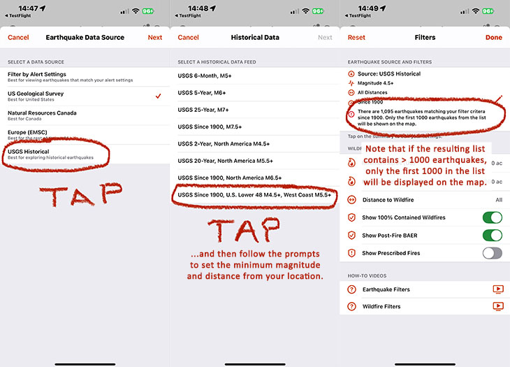
The USGS Since 1900 – U.S. Lower 48 M4.5+, West Coast M5.5+ historical data option displays all earthquakes in the contiguous United States since 1900, using a minimum magnitude of M5.5 for West Coast states (California, Oregon, Washington) and M4.5 for the rest of the Lower 48.
To view historical earthquake data in QuakeFeed, tap the second button in the bottom row, then tap the Earthquake Source and Filters settings, then select Change Data Source from the popup menu.
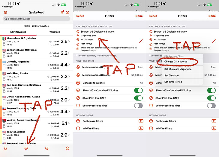
Select USGS Historical, then USGS Since 1900 U.S. Lower 48 M4.5+, West Coast M5.5+. Follow the prompts to set the minimum magnitude and distance from your location. Note that the defaults (M4.5+ and All Distances) will result in more than 1000 earthquakes. If the list includes more than 1000 earthquakes, the map will only be able to display the first 1000 earthquakes in the list.
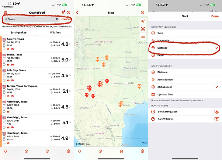
You can narrow down the earthquake list using the Filter settings or the Search box—for example, by typing a U.S. State name to view earthquake events in that state. Alternatively, tap the third button in the bottom row and Sort the list by distance. This will ensure that the 1,000 earthquakes closest to your location are displayed on the map.
The Historical Earthquake feature requires a QuakeFeed Premium subscription. QuakeFeed Premium is FREE for 30-days for new subscribers. Includes historical earthquakes, wildfires, smoke forecast, tropical storms, and more.
- Tap the Settings button (bottom right corner) or the Crown (top right corner).
- Tap the blue Redeem Your Free Month button.
Family Sharing
Share your QuakeFeed Premium subscription with up to five family members!
- How to set up Family Sharing in iOS (https://support.apple.com/en-us/HT201088)
- How to Share Purchases with your Family (https://support.apple.com/en-us/HT201079)
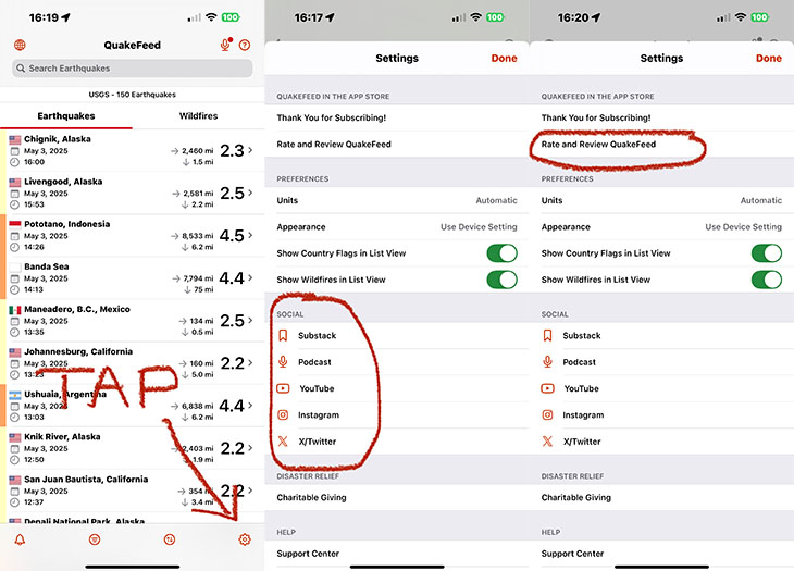
Social Links on Settings Screen
We included links to our substack, instagram, podcast, etc on the Settings screen. Tap the button in the bottom right corner to view the Settings screen. While you’re there, we’d be so grateful if you would rate / review us on the App Store. It only takes a moment, and it really helps support the work we’re doing here at QuakeFeed.
Substack News Page
Our Substack is free. We post earthquake and wildfire news, along with answers to FAQs, safety tips, and product announcements. We have also started integrating this news feature into different parts of the QuakeFeed app, such as the Earthquake Details screen.
Burned Area Emergency Response (BAER)
In the months after a major wildfire has been contained, there may be ongoing information posted on the Burned Area Emergency Response (BAER) page on Inciweb. We thought it would be helpful and important to include this information in QuakeFeed, so we added Post-Fire BAER to the wildfire list and map. The Show Post-Fire BAER setting is turned on by default, and the BAER details screen includes a link to the BAER page on Inciweb.
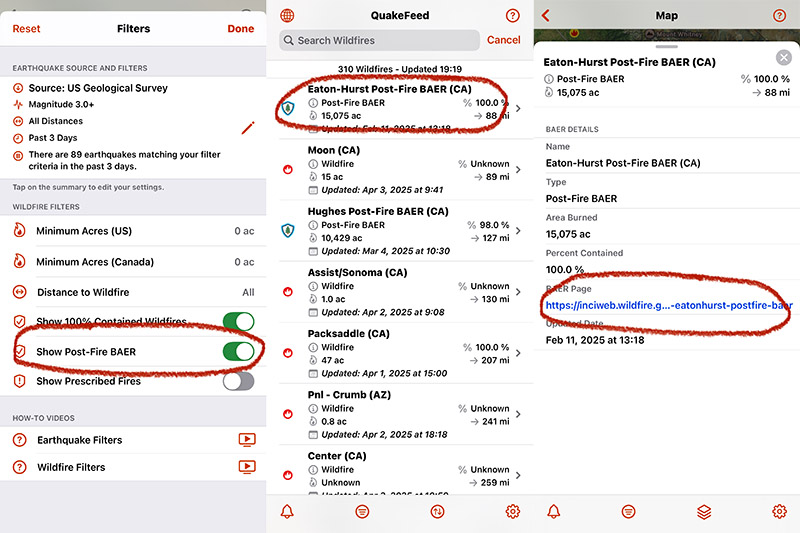
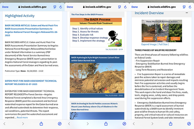
The BAER page includes assessment reports, maps and photographs of the burned area, and information about wildfire recovery.
PLEASE RELY on your county and / or your local fire agency for emergency alerts and safety information. QuakeFeed is for education and learning only.
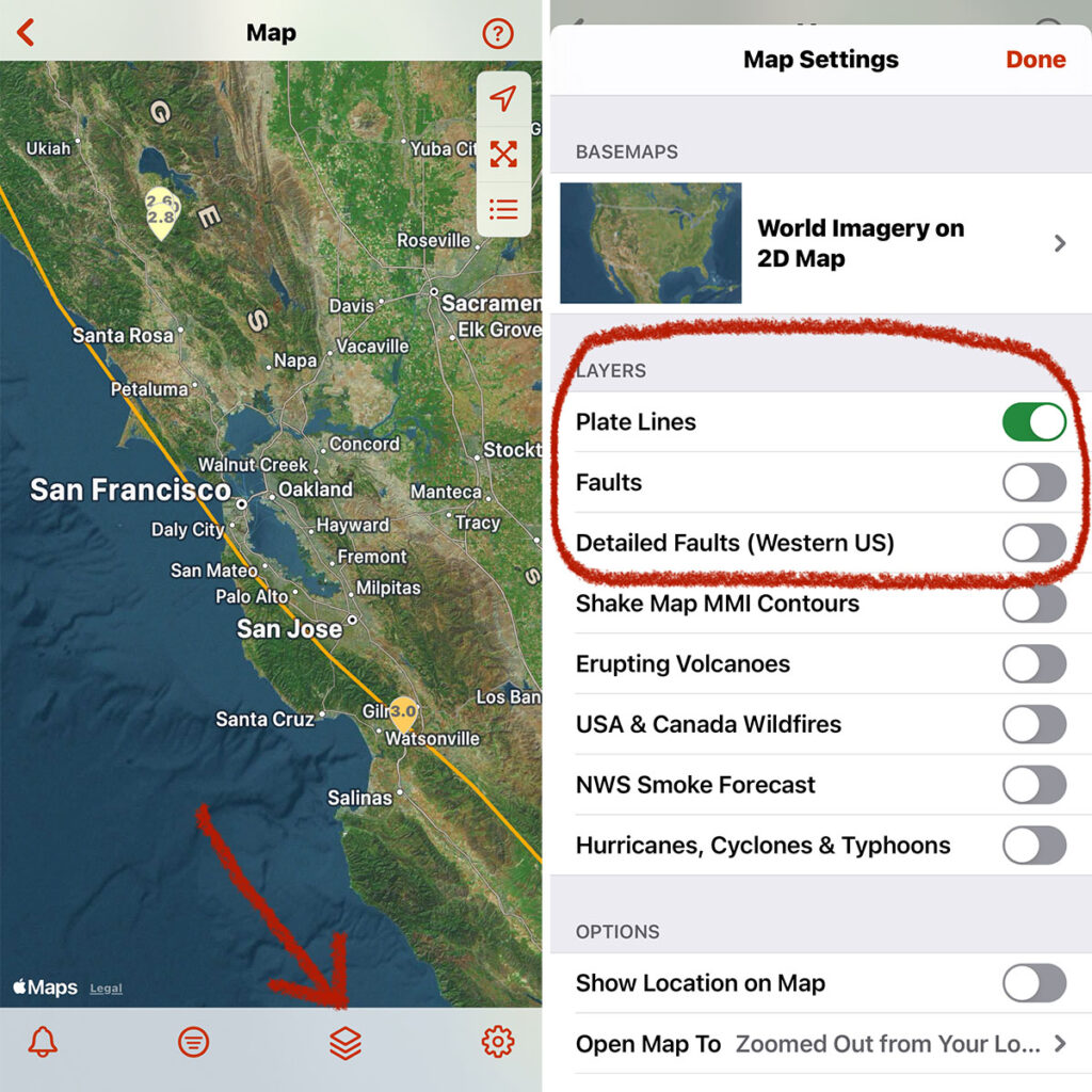
REMINDER ABOUT THE PLATE LINES AND FAULTS MAP LAYERS…
To improve the speed of the map, we adjusted the default settings so that the faults layers are turned off. If you would like to turn on the Faults and/or Detailed Faults map layers, tap the third button in the bottom row of buttons.
PLEASE NOTE:
- The Detailed Faults map layer covers only the USA west of the Rockies, is only displayed when an earthquake is selected, and only includes faults in the vicinity of the selected earthquake.
- The Faults map layer includes faults from the USA plus other parts of the world.
We encourage you to be curious and experiment with both of these map layers and learn more about faults. Please let us know if you have any questions or you notice any problems. Tap the ? in the top right corner of QuakeFeed then tap Ask to send us a support email.
Dark Mode and Tinted Icons
When you have your device in Dark Mode, the QuakeFeed icon now has a dark background. And for you geeks out there who love Tinted Mode, the QuakeFeed icon supports that as well. Tinted Mode in iOS that lets you change all your icons to the same color. To enable Tinted Mode:
- Long press an empty space on your Home Screen.
- Tap Edit in the top-right corner.
- Tap Customize.
- Select the Tinted option.
- Adjust the sliders to change the tint.
- Tap anywhere outside of the Customize panel to finish.
Feedback
If you have questions or notice any problems, please tap the ? in the top right corner, then tap Ask to send us a support request.
Please rate and review QuakeFeed in the App Store to help others find us. Thank you, and we hope you and your family stay safe!
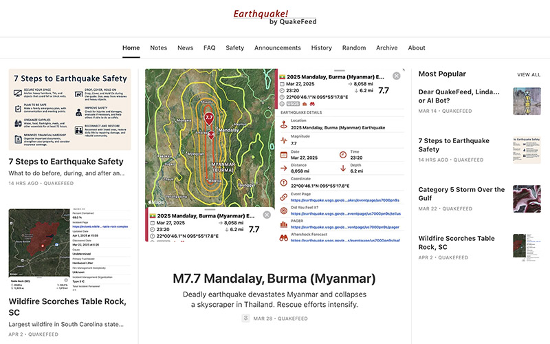
PS – Remember, the best way to protect yourself from injury during an earthquake is to Drop, Cover, and Hold On. This is a great time to review and practice.