You may wonder, “Why wildfires and hurricanes in QuakeFeed?”
- In the USA, “Earthquake Country” is also “Wildfire County”. Many people are interested in both.
- Some parts of the world are hit by earthquakes and hurricanes. Case in point: the August 14th M7.2 quake in Haiti, followed by Tropical Storm Grace two days later.
v5.2 is PACKED with NEW FEATURES!
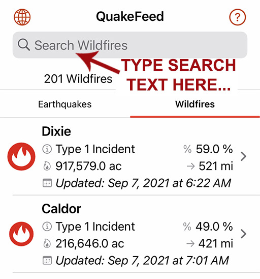
Wildfire List View
Premium-only feature
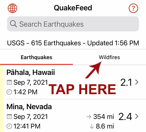
Tap the headings at the top of the list to toggle between the Earthquake and Wildfire lists.
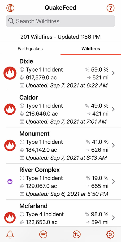
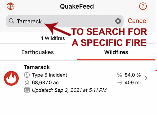
Search Wildfire List
Premium-only feature
Search for a specific wildfire by name.
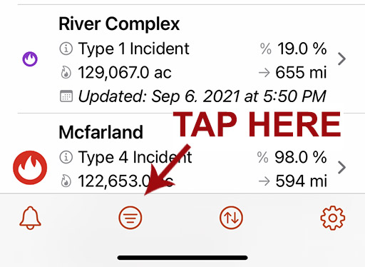
Filter Wildfires
Premium-only feature
Options to filter by Minimum Acres Burned or Distance from your location.
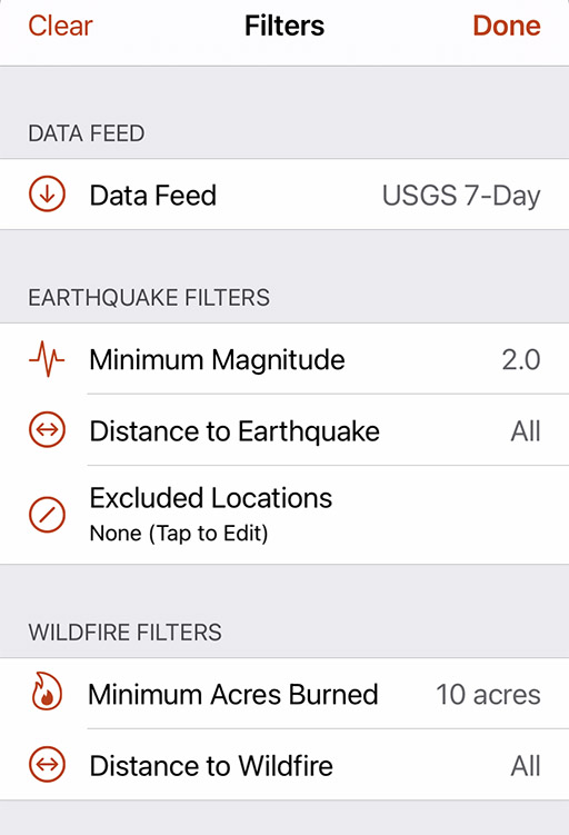
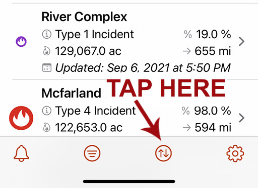
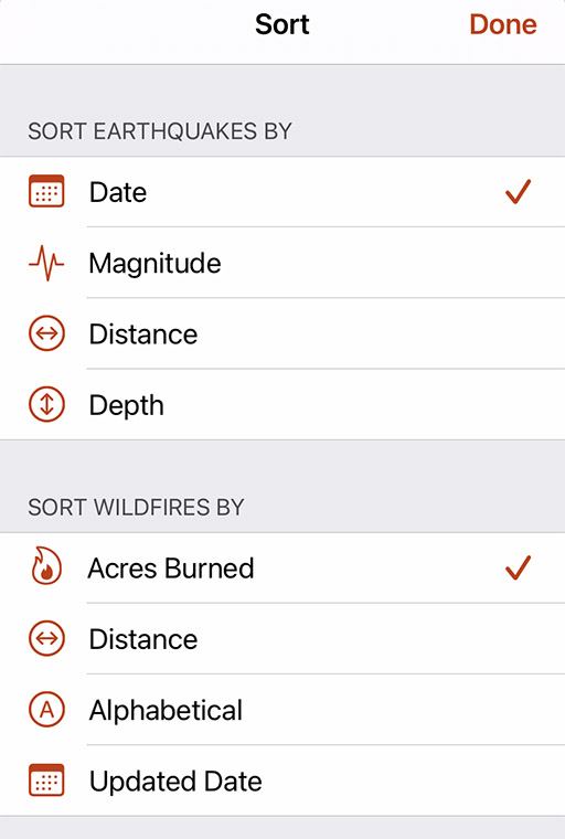
Sort Wildfires
Premium-only feature
Sort the list by Acres Burned, Distance from your location, Alphabetically by name, or the Updated Date.
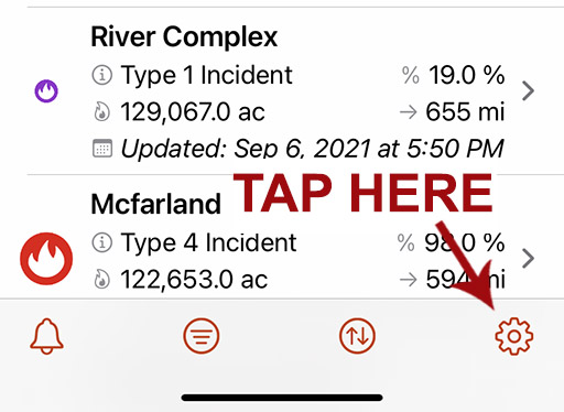
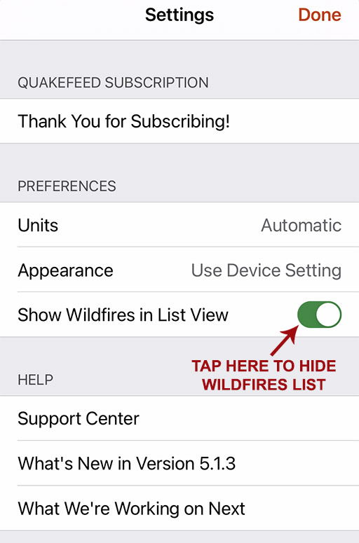
Hide Wildfires
Tap the Settings button (bottom right) then turn off the Show Wildfires in List View setting.
PAGER Info
Earthquake details now include a direct link to the PAGER info on the USGS Website.


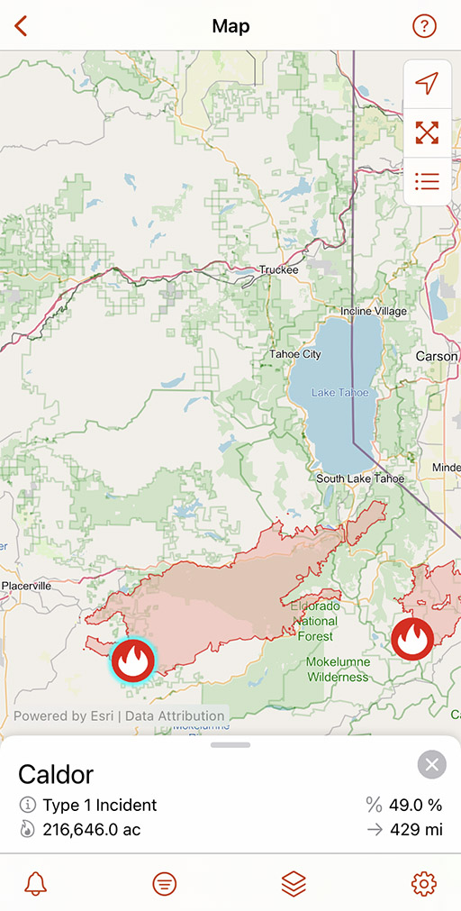
OpenStreetMap With Imagery Basemap
We have added a second OSM basemap, a hybrid of satellite imagery plus OSM reference information. Better for viewing earthquakes in Haiti because more towns, roads, bridges, etc are labeled.


Hurricanes Data Layer
Premium-only feature
Includes observed track, forecast track, and forecast cone. Tap a point along the track for more info.

Podcast
We recorded a quick bonus podcast (not a full episode) announcing QuakeFeed v5.1.0.
Episode 3: Drop, Cover, Hold On!
We use a bit of humor to help you learn how to protect yourself during an earthquake.
Episode 2: A Trip Down Market Street
A time travel adventure! We journey to San Francisco in April 1906 and ride a cable car down Market Street, just days before the 1906 San Francisco Earthquake.