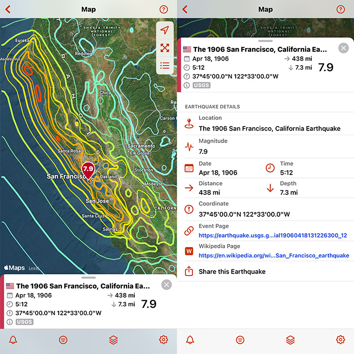
On April 18, 1906, San Francisco was rocked by a M7.9 earthquake followed by a fire that took more than 3,000 lives and destroyed 80% of San Francisco. View the 1906 earthquake in QuakeFeed using the Historical Data Feed and turn on the MMI Contours map layer to visualize the intensity of ground shaking across the region.
Historical Earthquake Data and the MMI Contours map layer require a QuakeFeed Premium subscription, which is FREE for 30 days for new subscribers! Tap the crown in the top right corner to learn more. For help with using these QuakeFeed features, refer to these How To videos:
How to Use Earthquake Data Source and Filters
Want to Learn More?
Read our Substack post on the 1906 Earthquake or listen to our podcast episode, A Trip Down Market Street, which was inspired by the silent film A Trip Down Market Street, shot just days before the quake.
We take you back to April 14, 1906, as a streetcar rolls down bustling Market Street, capturing a city on the brink of disaster. Then we fast-forward to April 18, 1906 to witness the destruction, the fires, and the turning point it created for earthquake science.